Cape Cod Beach Guide
All Beaches
Tom Never Beach — photo 1
1 / 5

Heads up

  • Piping plover nesting closure active this month — sections of the beach may be roped off.
  • High rip-current risk. Swim near a lifeguard and ask about conditions.
  • No lifeguards; strong rip currents.
Ocean / SurfFree & OpenHidden gemBest in September

Tom Never Beach

Nantucket, Massachusetts · Atlantic Ocean

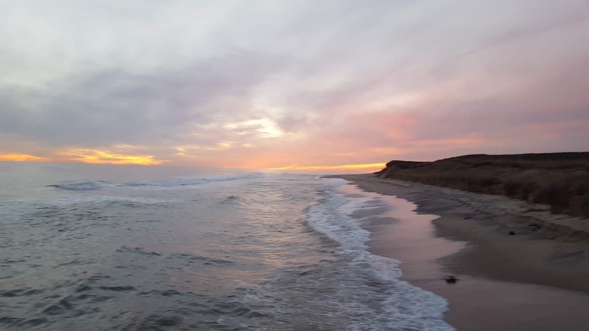
Nantucket's quiet far-east beach — long walks, surf fishing, no one

The easternmost south shore beach, far from the main tourist areas. Strong surf and a remote, windswept character. Excellent for surf fishing and long, solitary walks.

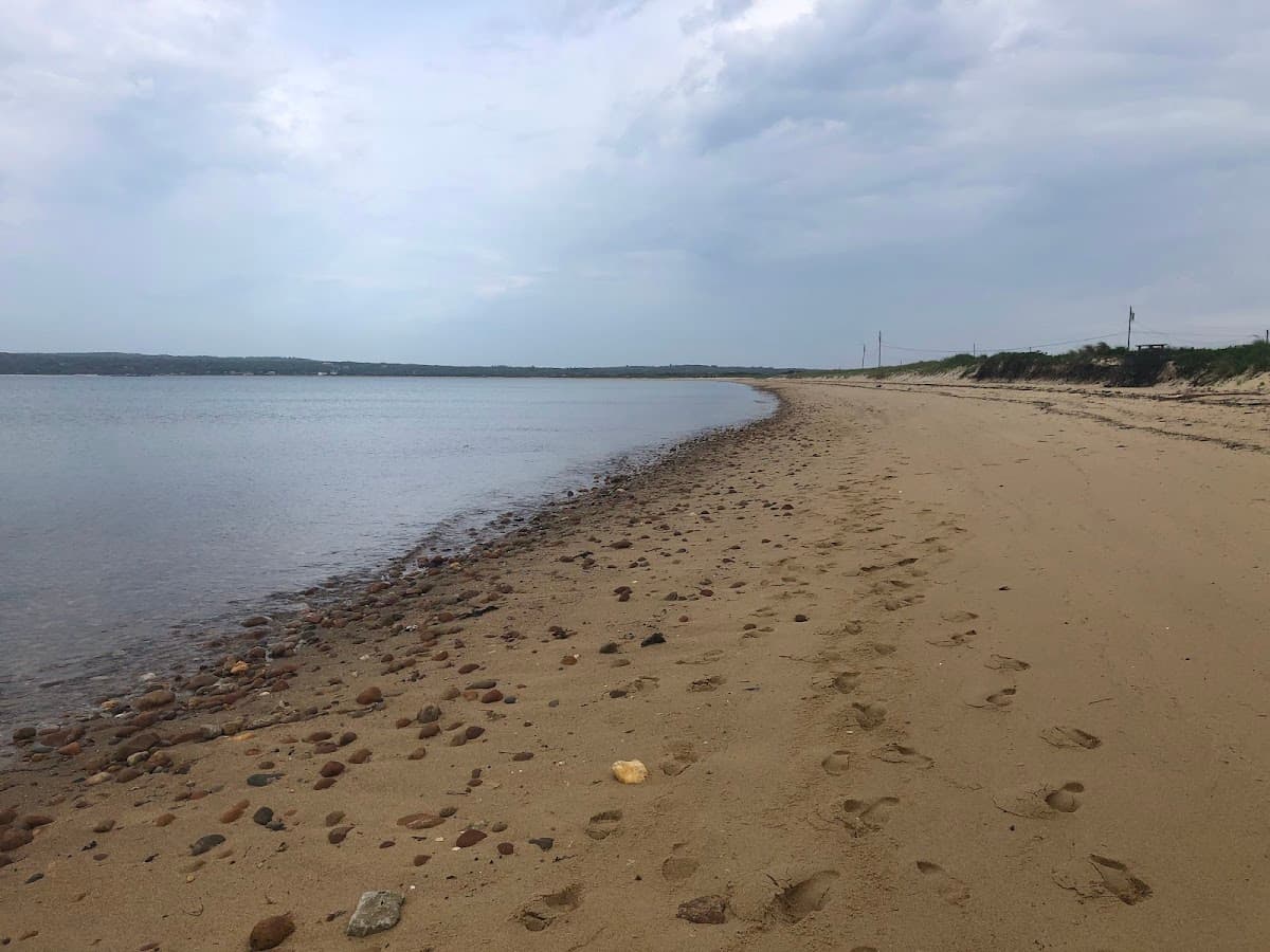
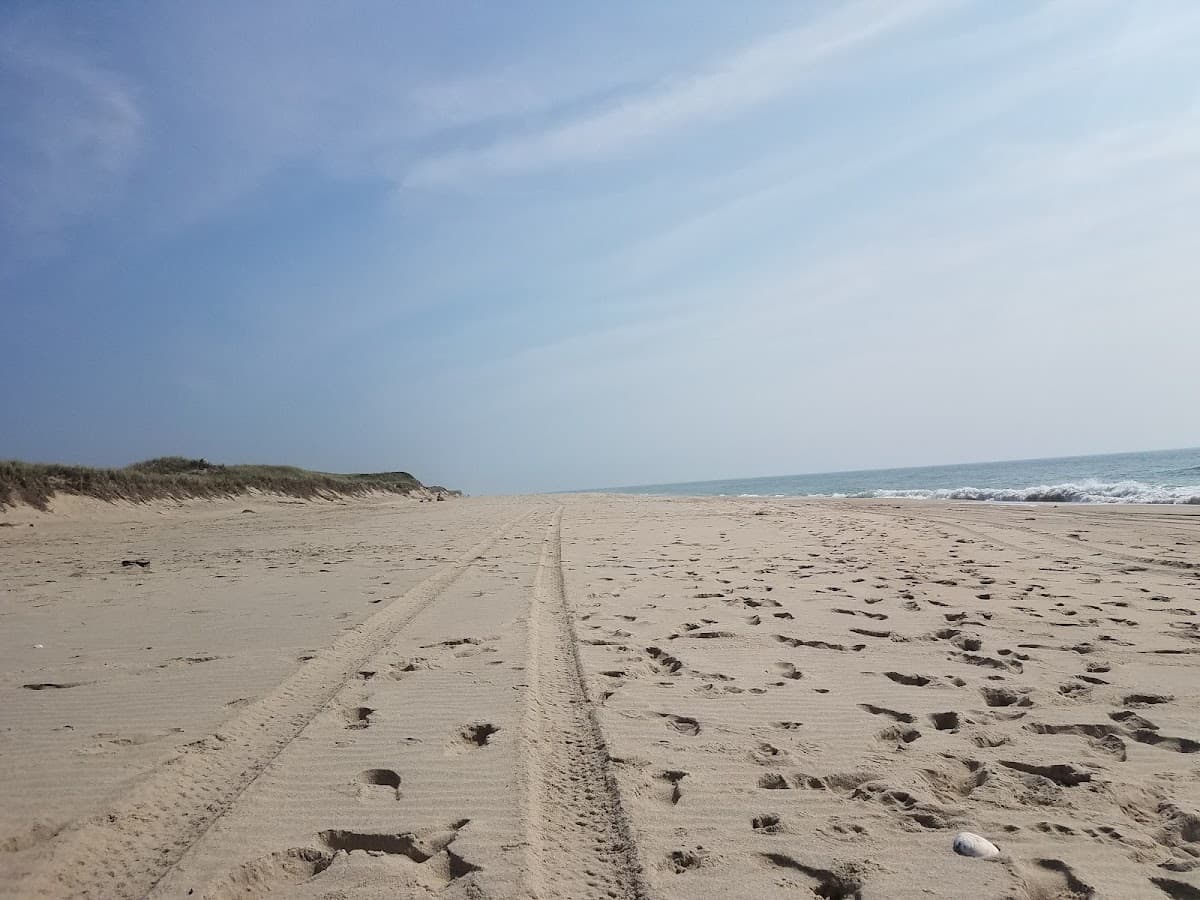
Tom Nevers is what's left when you keep driving past everything else — the easternmost stretch of Nantucket's south shore, far enough from downtown that even on the busiest summer weekend you can usually walk for half an hour and not see another person. There's a small parking lot at the end of Tom Nevers Road (variously labeled Tom Never and Tom Nevers; locals use Nevers), a soft-sand path through dune grass, and then miles of open Atlantic beach. No lifeguards, no facilities, no shade. The fishing is good, the walking is better, and the rip currents are real. The adjacent Tom Nevers Field is the island's old Navy base, now a public open space with one of the best kite-flying meadows in town.

Photo spot

Long view east toward Sconset with empty sand in the foreground

Arrive
Anytime — almost always empty
Crowds
Low
Dogs
Welcome

Best for

SeclusionWalkingFishingBirding

The beach

Lay of the land

Orientation
South-facing
Length
~1.5 mi
Backshore
Dune / flat
Sand
Fine tan sand backed by dune grass
Shade
none

Wildlife

Birds you may see: piping plover, least tern, American oystercatcher, sanderling, northern harrier

Occasional whales

Things to know

  • Occasional seal haul-outs nearby — a shark factor on outer-Cape waters.
  • Jellyfish more likely in August.

Plan your visit

Parking & fees

Lot size
Small
Enforcement
Free; small lot.

End of Tom Nevers Road, limited

Getting there

Ferry
60 min from Hyannis · Steamship Authority (fast ferry)
Cell signal
spotty

Accessibility

Beach wheelchair
Not available
Mobi Mat
No
Path from parking
soft sand walk

Dogs

Allowed on leash; restricted in plover closure zones.

Rules & activities

What’s allowed

UmbrellasTents / canopies · small onlyAlcoholGrillsFiresDronesSmoking

Activities

Surf · beach break · intermediateFishing · surfcasting

Safety & stewardship

Significant plover closures

Photo by Drew McNeil via Google Places

Today

Sunrise5:07 AM
Sunset8:14 PM

Conditions

WavesSurf / Strong
Water62–68°F (July–Aug)
TidesModerate
SharksModerate
Jellyfishlow
Length~1.5 mi
Open in Google MapsOfficial town page

Ratings updated 4 days ago

You might also like

Bay / Calm

Eel Point Road

Nantucket, MA

Plover closureHidden gem
No rating0
NatureSeclusionBirdingWalking
Calm waterUncrowdedDog-friendlySunsets
Lobsterville Beach beach in Martha's Vineyard, Massachusetts
Bay / Calm

Lobsterville Beach

Aquinnah, Martha's Vineyard, MA

Plover closureHidden gem
(16)
FishingSeclusionWalkingBirding
Calm waterUncrowdedDog-friendly
Miacomet Beach beach in Nantucket, Massachusetts
Ocean / Surf

Miacomet Beach

Nantucket, MA

Plover closureHidden gemSurf · intermediate
(61)
WalkingSeclusionFishing
Surf wavesUncrowdedDog-friendlySunsets