Bay / Calm
Cold Storage Beach
Dennis, MA
Hidden gem
(95)
WalkingSeclusionNature
Calm waterUncrowdedSunsets
Provincetown, Massachusetts · Cape Cod Bay
Provincetown's wild dune-tip wilderness beach
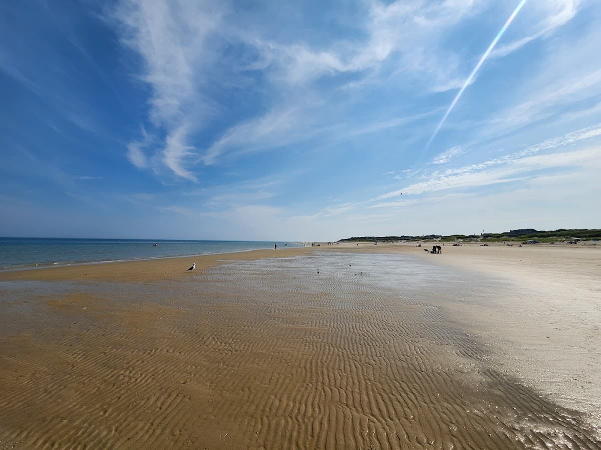
At the very tip of the Cape's curled fist, accessible only by walking the stone breakwater or taking a water taxi. The reward is near-total seclusion and pristine bay swimming. The walk across the breakwater is an adventure in itself.
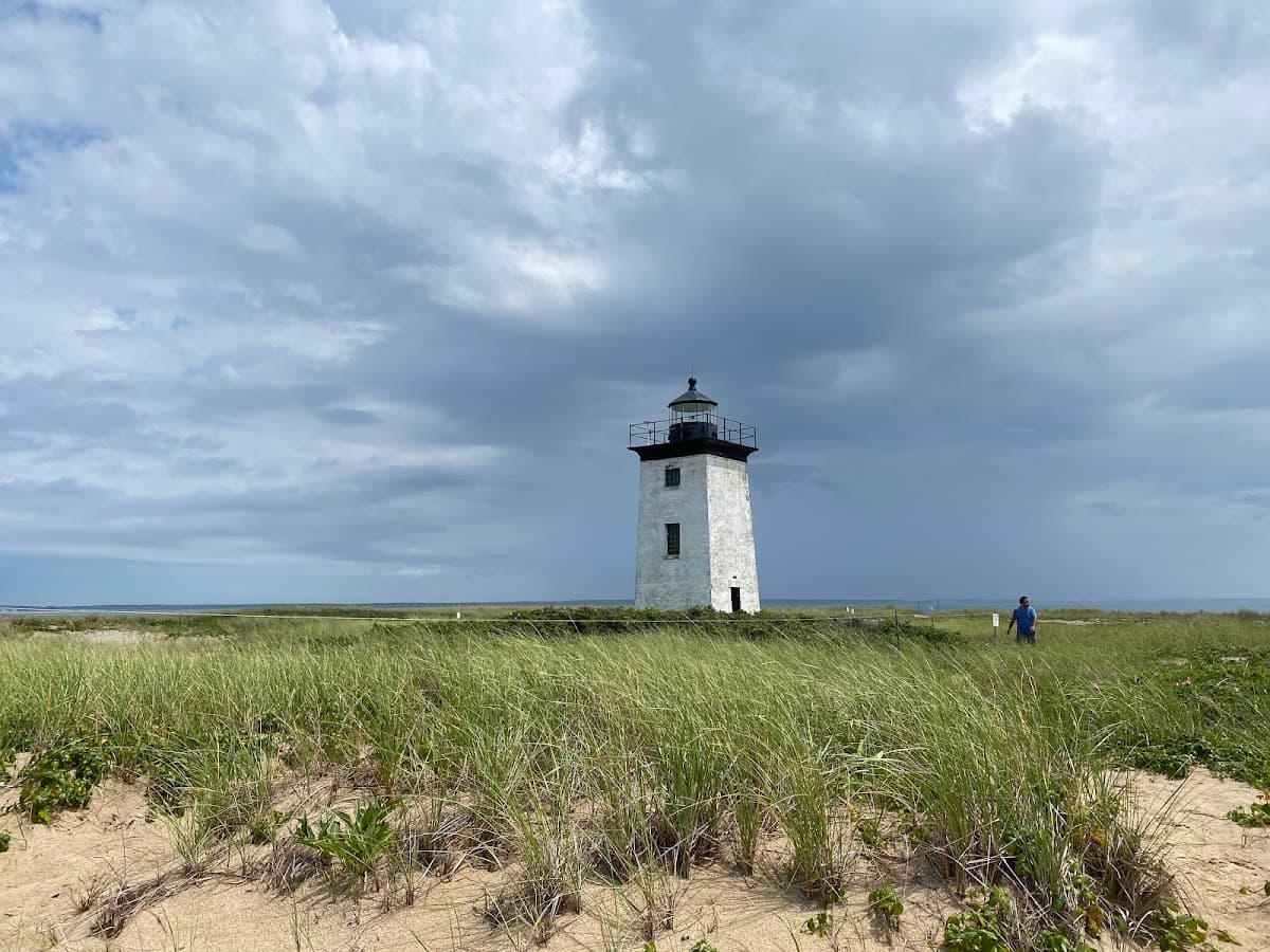
Long Point is the literal end of Cape Cod — a thin curl of dune sand at the very tip of the peninsula's curled fist, reachable only by walking the 1.5-mile stone breakwater across the harbor mouth from the West End of Provincetown, or by paying for a water taxi from MacMillan Pier. The breakwater walk is half the experience: a slow scramble over irregular granite blocks at sea level, with the harbor on one side and the salt marsh of the West End on the other, taking 45 to 60 minutes each way (check the tide — the marsh side floods). The reward is a long, empty crescent of bay sand with the Long Point Light at one end, the abandoned World War I-era forts (Fort Useful and Fort Ridiculous) at the other, and pristine bay swimming with views back across the harbor to the Pilgrim Monument. There are no facilities at all, so bring water, sunscreen, and shoes you can walk back in. The seal haulout off the point is reliable in shoulder season.
History
Long Point was the site of a small fishing village abandoned in the 1850s when houses were floated across the harbor to the present-day West End.
Photo spot
Long Point Light with the Pilgrim Monument across the harbor
Birds you may see: piping plover, American oystercatcher, common tern, least tern, great cormorant
Things to know
Accessible by foot (1.5-mile walk on breakwater) or boat
Dogs allowed on-leash; no dogs in lifeguarded swim areas — minimal at Long Point.
Photo by Ayesha Ahmad via Google Places
Parking at Long Point Beach is free and open to the public, but lots fill early on summer weekends — arrive before about 10am for the best chance of a spot.
Dogs are not permitted at Long Point Beach during the summer season — Dogs allowed on-leash; no dogs in lifeguarded swim areas — minimal at Long Point.
No — Long Point Beach does not have lifeguards on duty, so swim with caution.
Long Point Beach does not have public restrooms on site, so plan accordingly.
Long Point Beach is a calm, bay-side beach on Cape Cod Bay. Expect calm, gentle water that's good for young kids and easy swimming. Average summer water temperature is around 62-68°F (July–Aug).
Long Point Beach is especially good for seclusion, walking and nature.
Mid-morning to allow a 90-minute breakwater walk each way; check tide.
Dennis, MA
Sandwich, MA
Nantucket, MA
Long Point Beach also appears on: Best for secluded · Best for free parking