National Seashore
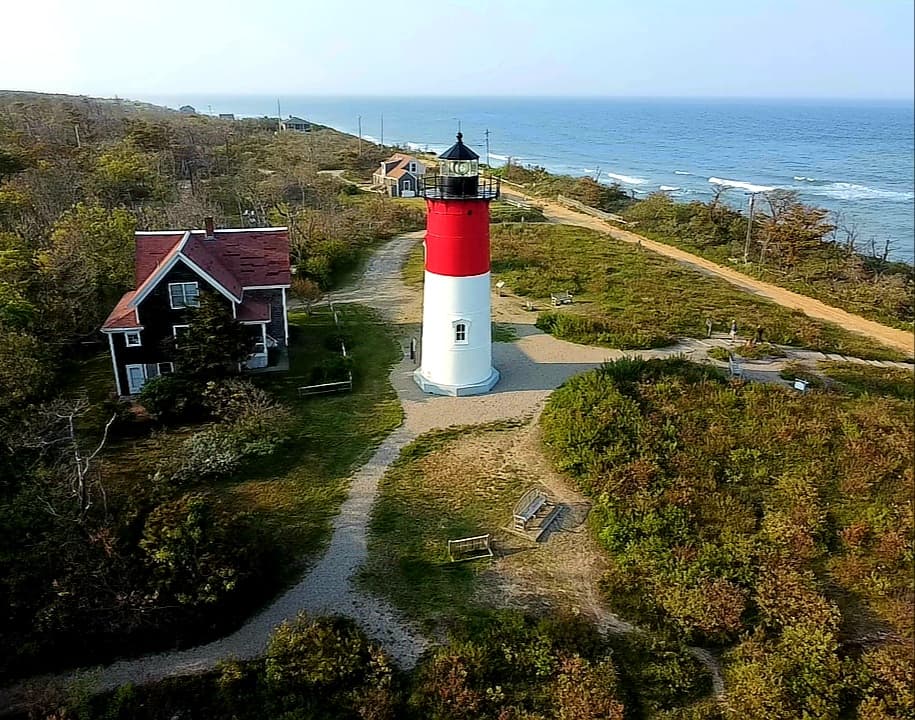
Nauset Light Beach
Eastham, MA
Plover closureAccessibleSurf · intermediateSeal viewing
(869)
SwimmingSceneryLighthouse
Surf wavesLifeguards
Wellfleet, Massachusetts · Atlantic Ocean
Wellfleet's national-seashore cliff-back Atlantic beach
Named for Guglielmo Marconi's wireless telegraph station. Towering sand cliffs drop to a wide Atlantic beach. The dramatic erosion here is a visible reminder that the Cape is always changing.
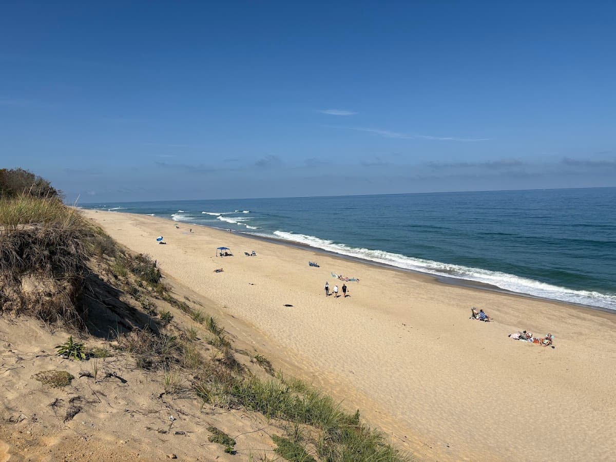
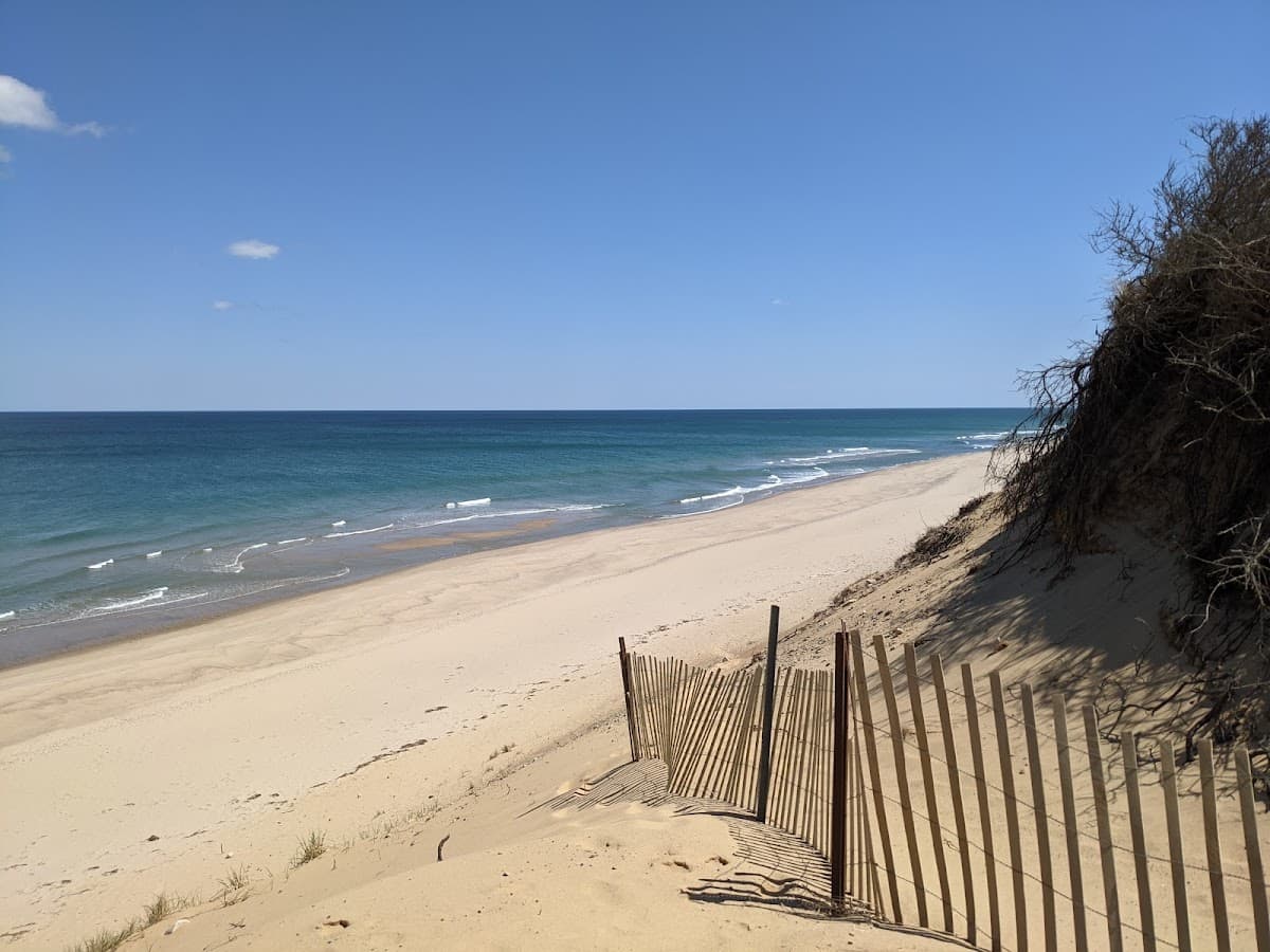
Marconi Beach is the southernmost of the National Seashore's grand Atlantic beaches on the Outer Cape — a wide, lifeguarded strand at the foot of 70-foot eroding sand cliffs, with the largest paid-lot National Seashore facility this side of Race Point. The beach is named for the wireless-telegraph station Guglielmo Marconi built on the cliff above in 1903 — his transmitter sent the first transatlantic wireless message from US soil to King Edward VII in 1903. The original station site is gone, eroded into the sea over the last century along with the cliff itself, but a small interpretive overlook marks its former location. The beach below is broad and beautiful with a long view north toward Lecount and south toward Marconi Station Beach in Eastham; the swimming is true Atlantic with real waves and a strong longshore current. The dune-cliff staircase is steep — eighty-five steps — and the National Seashore replaces it every few years as the cliff retreats. White-shark patrol is active here in season.
History
Marconi's 1903 wireless station — the first to send a transatlantic message from US soil — once stood on the cliff above this beach; the site has since eroded into the sea.
Photo spot
The Marconi overlook with the cliff dropping to the Atlantic
Birds you may see: piping plover, American oystercatcher, northern gannet, common tern, least tern
Things to know
National Seashore pass or $25/day
Dogs allowed on-leash in National Seashore sections outside lifeguarded swim area.
Photo by Nataliia Shakhgildian via Google Places
Late June through Labor Day, 9am–5:30pm
Marconi Beach is part of the Cape Cod National Seashore and requires a seashore parking pass (sold daily or seasonally).
Dogs are not permitted at Marconi Beach during the summer season — Dogs allowed on-leash in National Seashore sections outside lifeguarded swim area.
Yes — Marconi Beach is staffed by lifeguards during the summer season (Late June through Labor Day, 9am–5:30pm).
Marconi Beach has public restrooms and showers available in season.
Marconi Beach is a Cape Cod National Seashore beach on Atlantic Ocean. Expect bigger surf and waves — better for bodyboarding and confident swimmers. Average summer water temperature is around 58-64°F (July–Aug).
Marconi Beach is especially good for swimming and scenery.
Mid-morning weekdays, before 9am summer weekends.
Eastham, MA
West Tisbury, Martha's Vineyard, MA
Truro, MA
Marconi Beach also appears on: Best for surfing · Best for national seashore · Best for accessible